PRF Highlights
In 2022, CCBWQA contributed over $2.32 million towards pollution reduction facilities and pollution abatement projects in the watershed.
In 2022 work was performed on three key Pollution Reduction Facilities:
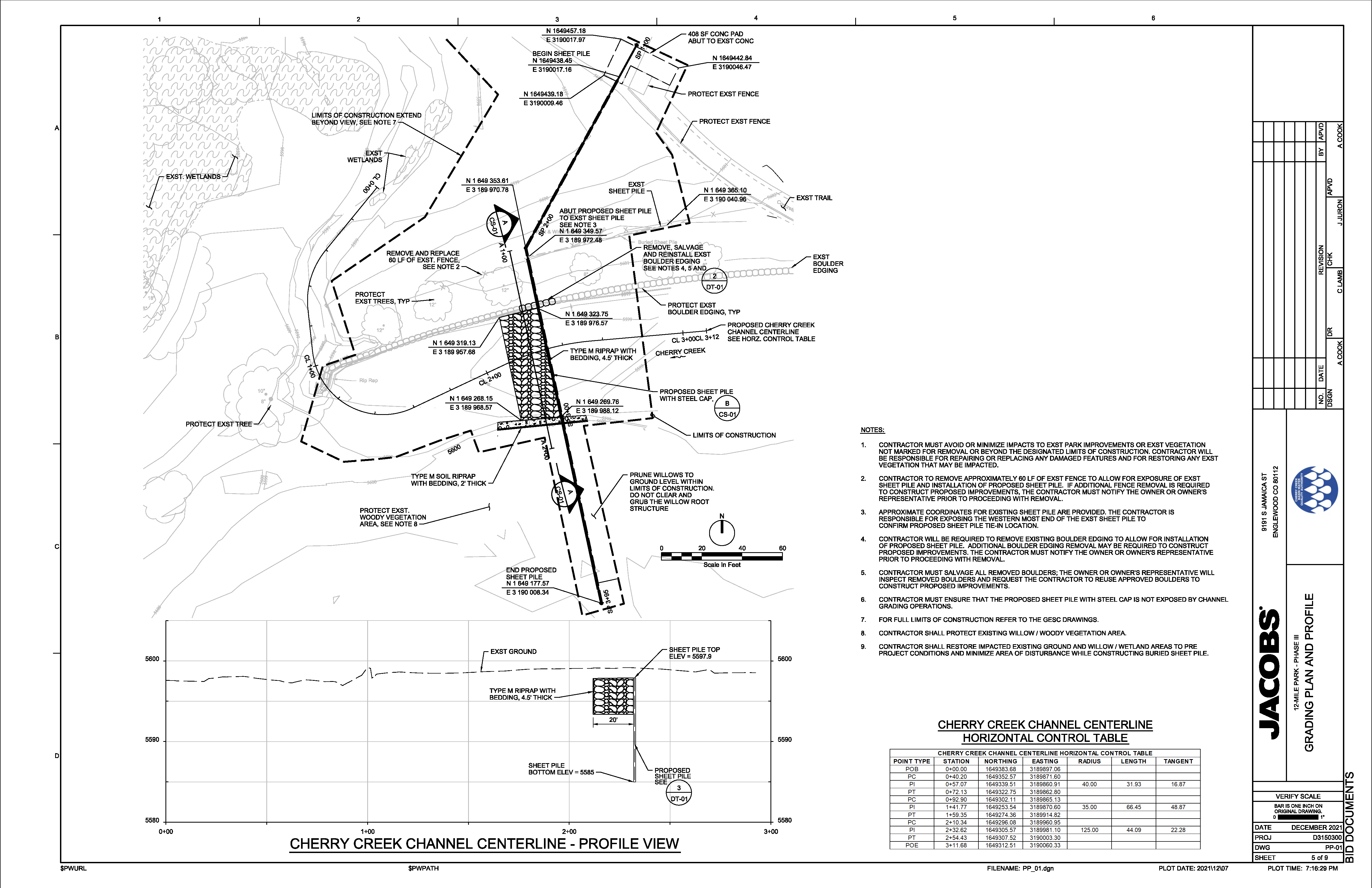
Cherry Creek Stream Reclamation at 12-mile Park Phase 3 Project
Click on the map to see an enlarged version
Total Project Cost
$443,000
Authority's Share
$443,000
Engineer
Jacobs (previously CH2M)
Contractor
53 Corporation
More Info
In June 2012, the Cherry Creek Basin Water Quality Authority (CCBWQA) completed the first phase of the Cherry Creek Stream Reclamation at 12-mile Park. In June 2014, CCBWQA completed the second phase of the Cherry Creek Stream Reclamation at 12-mile Park. In 2015, sediment began to deposit within the Phase 1 reach. In 2017, a breach occurred downstream of Phase 1. In November 2018, CCBWQA hired CH2M Hill Engineers, a subsidiary of Jacobs Engineering Group (Jacobs/ch2m), to provide alternative analysis and ultimately design of the third phase of Cherry Creek Stream Reclamation at 12-mile Park. Stream Reclamation reduces erosion and immobilizes nutrients (including phosphorus and nitrogen) in the soils, reducing nutrient loading to Cherry Creek and Cherry Creek Reservoir. The Project helps to maintain the existing water quality benefit of the previous phases which immobilize an estimated 52 pounds of phosphorus per year, and it provides new stream reclamation that immobilizes an estimated 1 pound of phosphorus per year.
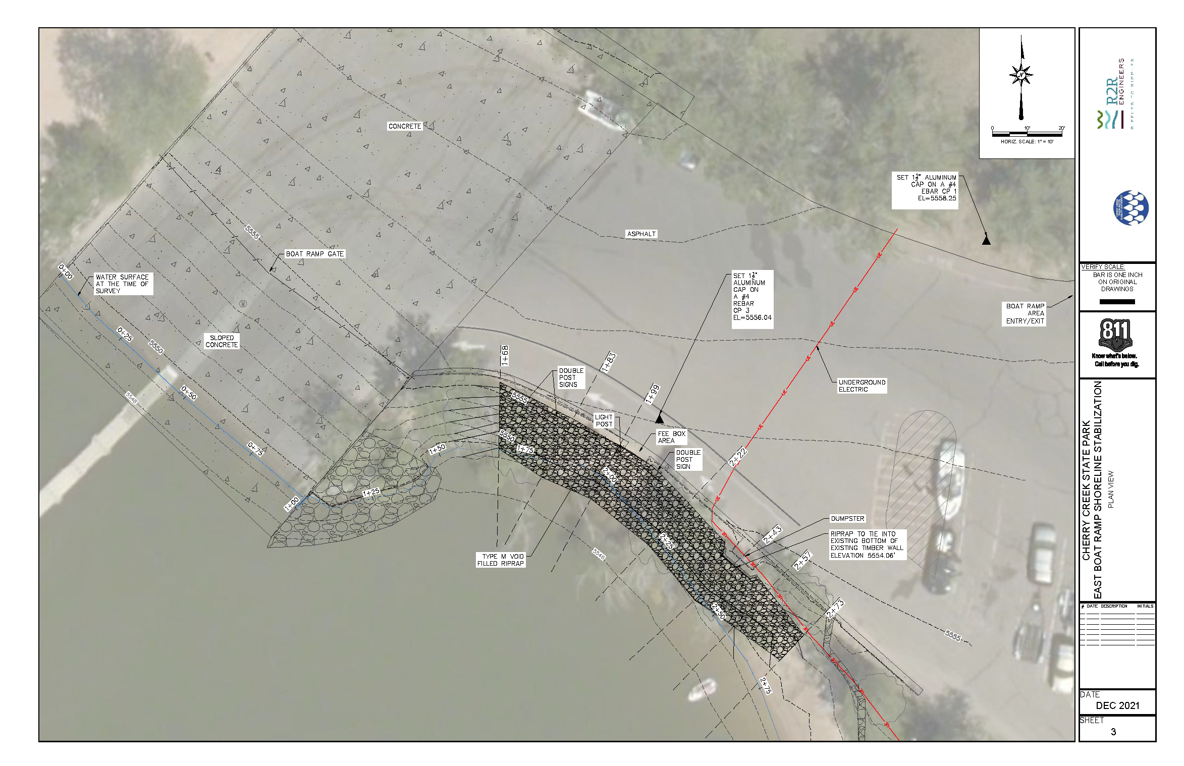
East Boat Ramp Shoreline Stabilization Phase 2
Click on the map to see an enlarged version
Total Project Cost
$91,000
Authority's Share
$91,000
Engineer
R2R Engineers
Contractor
53 Corporation
More Info
The 2018 Annual Inspection of Pollution Reduction Facilities (PRFs) noted, “…that an area of shoreline adjacent to the boat ramp and previous shoreline is unraveling and threatening adjacent infrastructure and trees.” The East Boat Ramp Phase 2 Shoreline Stabilization Project is located on the east side of Cherry Creek Reservoir just south of the boat ramp. R2R Engineers provided the design of the shoreline stabilization. Shoreline stabilization minimizes erosion of shoreline soil and the attached phosphorus from being deposited directly into the reservoir. The Project immobilizes an estimated 12 pounds of phosphorus per year.
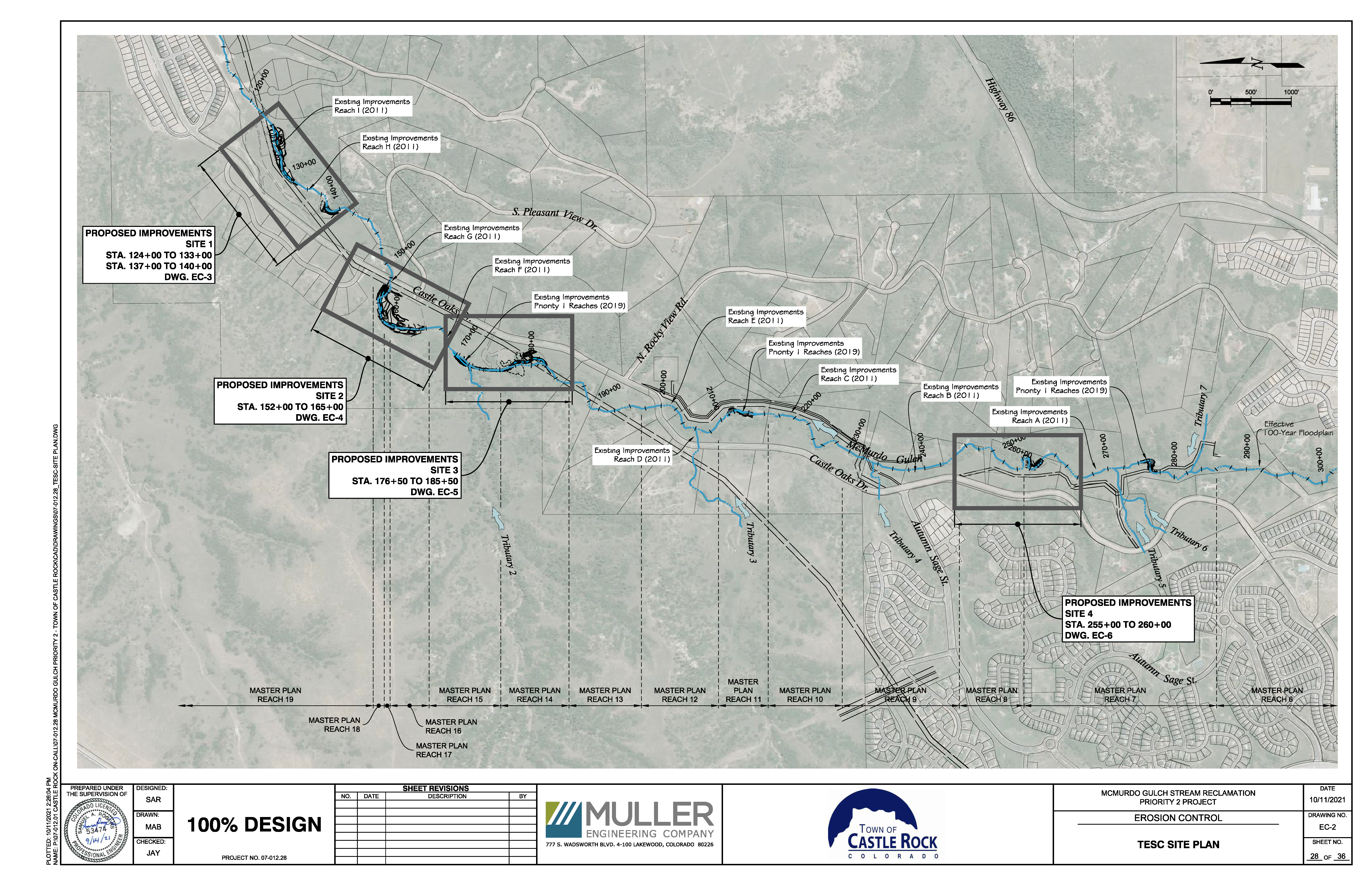
McMurdo Gulch - 2022 Stream Reclamation Project
Click on the map to see an enlarged version
Total Project Cost
$1,926,000
Authority's Share
$482,000
Engineer
Muller Engineering Company
Contractor
Tezak Heavy Equipment
More Info
The McMurdo Gulch 2022 Stream Reclamation Project continues the partnership between the Town of Castle Rock and CCBWQA on McMurdo Gulch, which began with the 2011 Project and the 2020 Project. McMurdo Gulch is a western tributary to Cherry Creek that is 6.7 miles long and has a watershed area of 6.5 square miles. The 2022 Project includes stream reclamation of approximately 3,700 Linear Feet which provides water quality benefits for the stream and ultimately Cherry Creek Reservoir. Stream reclamation reduces erosion and immobilizes nutrients (including phosphorus and nitrogen) in the soils, reducing nutrient loading to Cherry Creek and Cherry Creek Reservoir. The 2022 Project immobilizes an estimated 63 pounds of phosphorus per year.